

When and where Storm Lorenzo will make landfall in Ireland

Coverage brought to you in association with Abbey Tree Services

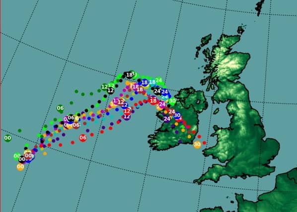
The national forecaster states that strong winds and large waves will affect western and southern coasts this evening and tonight with the potential for coastal flooding and damage. Lorenzo is expected to fill quite rapidly as it tracks south-eastwards over the country overnight.
Winds in the centre and to the north of the low will be generally light to moderate variable. There will, however, be pulses of heavier rain in the centre and to the north of the low, with a yellow rainfall warning in operation to account for this.
Met Eireann states that its model guidance is calling for some slight deepening of the Lorenzo low to take place this afternoon as the system tracks north-eastwards to the west of Ireland, reaching a low of possibly 962hPa at 14z (1500 local). Because of this, south-easterly winds will be strong and gusty over much of the country this afternoon, with a countrywide yellow wind warning in operation until 6pm today.
The storm depression is forecasted to then turn east south-eastwards this evening towards the west coast of County Mayo. This turn is due to upper air steering flows high up in the atmosphere. By this time, the depression will be starting to fill. What this means is that the storm force winds on the southern side of the low will begin to slowly subside.